Appalachian Trail in Cumberland Valley

The Appalachian Trail is the most famous hiking trail in the U.S., extending 2,190 miles from Georgia to Maine. 46 miles of the Appalachian Trail meanders through Cumberland Valley, Pennsylvania, including a 13-mile section that is one of the longest, lowest, and flattest sections on the entire trail (cornfield @ NOBO 1122.9 to PA 944 @ NOBO 1136.8) and one of the most accessible portions to park and take a short day hike. Take a wonder-filled nature walk along one of America's most iconic footpaths through forests, farmlands, and charming small towns, such as the picturesque A.T. Community of Boiling Springs.

Find more info below about hiking options along the Appalachian Trail in Cumberland Valley. Use this map with GPS coordinates for parking to help plan your trip.

While in Cumberland Valley, be sure to stop by TCO Outdoors in Boiling Springs for brochures and information about hiking the A.T. in Cumberland Valley and other things to see and do in the region.

Frequently Asked Questions

What is the best time of year to hike the Appalachian Trail?

Most thru-hikes begin in early March and end in mid-October. Hikers normally start in Georgia and head north, making the southern end of the trail particularly crowded in March and April. Thru-hikers may choose to start in Maine but the trail's northern most terminus is considered more difficult and involves extensive climbing, rock scrambling, and muddy terrain. It is suggested that only experienced and fit hikers begin in the north and travel south. In the Cumberland Valley, the A.T. is open to visitors year-round for day hikes or overnight camping, but hikers should avoid early spring when heavy and frequent rain makes the trail quite muddy.

How long does it take to complete the Appalachian Trail?

A typical thru-hiker takes 5 to 7 months to hike the 2,198 miles of the Appalachian Trail. Hikers are encouraged to start at a moderate pace and slowly increase their mileage as they get their "trail legs."

However, if you don't have time to complete the trail all at once, consider section hiking which is more accommodating to your schedule and allows you to complete the trail over a period of years.

How do I plan for a thru-hike along the Appalachian Trail?

One of your best resources is AppalachianTrail.org. Here you will find a list of resources to help you plan your trip including an interactive map, an online store to purchase how-go guides and videos, and information about connecting to past thru-hikers for tips and advice. Some initial steps: decide when and where you want to begin; register your thru-hike; plan your resupply points, and know the camping regulations along the A.T. Hikers should also prepare mentally and physically for the rigors of the trail.

How much does it cost to hike the Appalachian Trail?

A new set of backpacking gear runs $1,200 to $2,000 or more with lightweight gear costing more. Most hikers spend an average of at least $1,000 a month during the hike itself. Aside from trail food, you will need money for supplies, laundry, postage, and equipment repair and replacement. The additional cost of restaurant food and hotel beds should be factored in as you arrive in trail towns. Always set aside some money for emergencies.

There are no fees required to hike the A.T. in general, but there are a few sections where a permit is required.

How hard is it to hike the Appalachian Trail?

Hike the entire Appalachian Trail is rigorous and demanding -- both mentally and physically. The mountainous terrain is often rocky and hikers can expect to burn 4,000 to 6,000 calories a day. Hikers in Cumberland Valley enjoy a 13-mile section that is one of the lowest and flattest along the entire trail. But, don't be fooled. The Pennsylvania portion of the Trail often referred to as the section where "boots go to die."

Can I do an overnight hike along the Appalachian Trail in the Cumberland Valley?

Don’t have time to thru-hike the Appalachian Trail but still want to experience more than a day hike? Plan an overnight or weekend hike along the 46 miles of the A.T. that meander through the Cumberland Valley. While multi-day hiking is not as intimidating as thru-hiking, it still requires planning and preparation. Click here for important information to help you plan your adventure.

Free parking permits, including long-term parking, are available at the South Middleton Township office (717-258-5324).

What should I consider when planning my 2024 thru-hike?

To ensure hiker safety and health while on the A.T., hikers are asked to plan, prepare, and stay informed by undertaking the following:

  • Register your hike: If you plan a backpacking trip of any length — from an overnight trip to a full thru-hike — please register your hike at ATCamp.org. Registering your hike enables us to provide essential updates by text and/or email while you traverse the A.T. and gives you the means to choose a starting date and location to help reduce crowding.
  • Plan and prepare: The ATC’s Hiker Resource Library provides gear lists, safety protocols, hiking basics, trail updates, and other information to help keep you and other hikers safe and prepared for your A.T. hikes. 
  • Spread out: Crowding harms the A.T. To reduce crowding across the Trail, please spread out the dates and starting locations for thru-hikes. ATCamp.org includes up-to-the-minute registration charts that allow you to pick an uncrowded start date — choose your start date carefully or select an alternate starting spot.
  • Anticipate crowds: If you are a day visitor on the A.T., please consider a weekday hike. This will help disperse crowds and reduce parking difficulties. Be aware of local parking regulations.

Read more about hiker preparation, including basic information, Leave No Trace principles, essential tips for properly storing food, campsite selection, and making safety your #1 priority.

Hiking Suggestions

Hike #1

Bird at Letort

Park at Scott Farm Appalachian Trail Work Center. Scott Farm is the headquarters for A.T. trail maintenance activity for the Mid-Atlantic Appalachian Trail Conservancy, as well as one of the maintaining clubs, Cumberland Valley Appalachian Trail Club. A water spigot and portable toilet are available during spring, summer, and fall. Trail information can be found on the bulletin board and in a box on the side of the barn.

Cross the bridge on the pedestrian walkway, heading southbound on the A.T. Continue left into the woods along a wooden boardwalk constructed in 2005 to keep the trail above swampy land along the beautiful Conodoguinet Creek. You may see herons and other water birds. If you are more ambitious, continue through woodlots, farm fields, and across three major highways. Turn around and hike back to your car.

Hike #2

TCO Outdoors

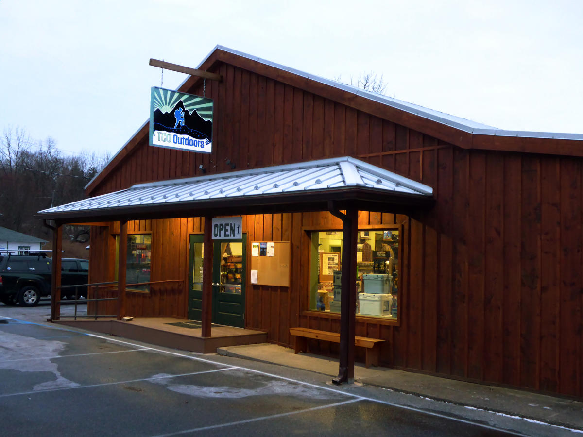
Boiling Springs is famous for its springs, the beautiful Children's Lake in the center of town, and the pre-Revolutionary War Carlisle Iron Works Furnace. Convenient parking is available at the former Mid-Atlantic office of the Appalachian Trail Conservancy (ATC) or at the Carlisle Iron Works Furnace. In addition to shopping for all your hiking and fishing needs at TCO Outdoors, you can also stop in for brochures and information on the A.T.

If you're hungry, there are several options in Boiling Springs, including Caffe 101 or Anile's. A supermarket is about a half mile up the road from Anile's. 

Option 1: The trail runs along the famous trout fishing stream, Yellow Breeches Creek. Follow the A.T. blazes across Bucher Hill Road, toward the ATC office, then along Children's Lake. Continue past the gazebo to the former Mid-Atlantic Office of the ATC. If you have extra time, cross Route 174 at the former ATC office and take the short trail running between the post office and the former Boiling Springs Tavern. There, you can see a stream leading to the bubbling waters that give Boiling Springs its name. Walk back along Children's Lake and return to your car.

Hikers on the Appalachian Trail
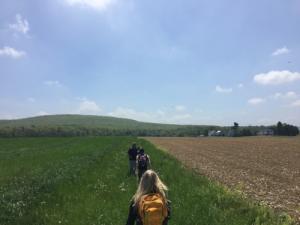
Option 2: If you are more ambitious, start at the Iron Furnace and continue south across the creek. Follow the Appalachian Trail as it goes left across the beautiful historical stone bridge and zig zags through farm fields for more than a mile. You’ll then begin a steady climb up South Mountain. The big holes in the ground are where they dug out iron ore for the foundry a couple of centuries ago. After a one-mile gradual climb, you'll reach the peak known as Center Point Knob. This was the exact center when the A.T. was first laid out in the 1930s. The midway point is now several miles south, near Pine Grove Furnace State Park. This option is about 2.5 miles one-way. There is a gradual 600-foot increase in elevation from beginning to end. Be prepared with a hat and sunscreen on sunny days. The section of the trail that passes through farm fields offers no shade.

Hike #3

Group of fathers and sons hiking along the Appalachian Trail

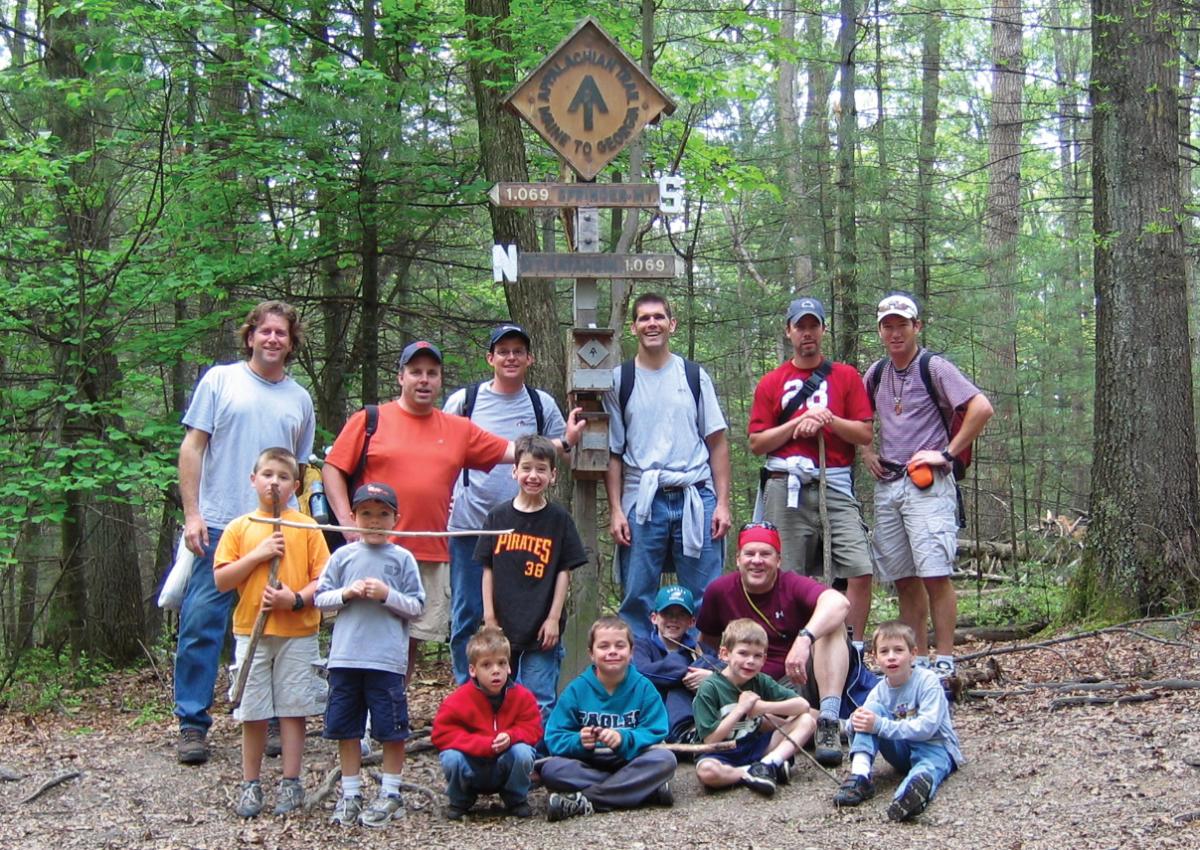
Park at the gravel lot by the Iron Furnace in Pine Grove Furnace State Park. 

Option 1: After visiting the A.T. Museum, follow the white blazes south, past Pine Grove General Store. The large building on your right is the newly restored Ironmaster's Mansion. Continue south on the AT for a mile or two until you see the prominent marker showing the actual midway point of the A.T., where all thru-hikers have their pictures taken. The actual spot changes a bit each year due to trail relocations. Retrace your route back to the car.

Option 2: Get a map from the Park Office. Then, travel north on the A.T. (away from the store and the Ironmaster's Mansion). Follow the white blazes past the beaches at Fuller Lake and head down a dirt road into the woods. After a short time, the A.T. will head off the road to the right, steadily climbing another ridge of South Mountain. In less than a mile after you start climbing, you'll see a sign directing you left off the trail onto the rock outcropping on Pole Steeple. Rather than going back on the A.T., you can go down the blue-blazed Pole Steeple Trail.  This is a much steeper trip down, so be careful. Take the A.T. back if you aren't sure-footed or if the weather is poor. If you take the Pole Steeple Trail, you'll come to a dirt road at the bottom. Go left, and in less than a mile, you'll connect up to the A.T. again. Follow the white blazes on the road back to your car in the parking lot.

Additional Appalachian Trail Information

  • OVERNIGHT CAMPING: Are you interested in overnight camping along the trail? Be sure to register your camping plans at ATCamp.org.  A registration is not a reservation but is a way to ensure a better hiking experience and help you avoid overcrowding at shelters and campsites. Read more about overnight hiking on the AT.
  • PARKING: Find a map and GPS coordinates for parking along the Cumberland Valley PA stretch of the Appalachian Trail. Also, find additional information about the Appalachian Trail here

Top
 

Must-See in Cumberland Valley

Discover and explore all the possibilities